|
Bay of Islands-Whangaroa
Community Board Meeting
Agenda
|
3 September 2026
|
7 Ngā
Pūrongo / Reports
7.5 Russell
Placemaking - Endorsement of Final Design for Cass Street
File
Number: A5905923
Author: Jaye
Michalick, Team Leader – Growth Planning & Placemaking
Authoriser: Kate
Ivicheva, Group Manager - Planning & Policy
Take
Pūrongo / Purpose of the Report
To seek a recommendation to Te Koukou Committee for
Transport and Infrastructure (Te Koukou), and then Council, and Te Kūkupa
Committee for Strategy, Policy and Regulation (Te Kūkupa), to approve for
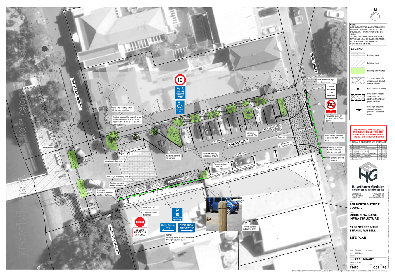
implementation a final design plan for changes to The Strand and Cass Street in
Russell-Kororāreka.
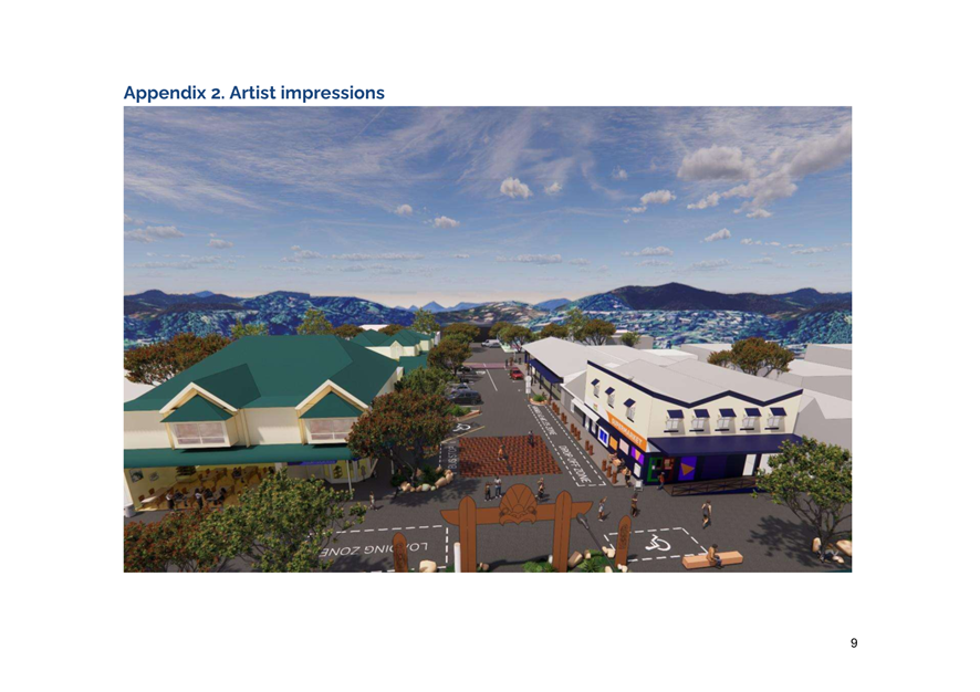
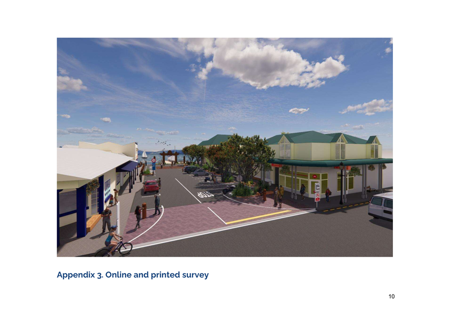
The design has been developed by a community working group
(the Russell Roading Working Group) and Council staff with support from a
transport engineer. This report discusses the proposed design, including
suggested changes to the design resulting from public engagement in June and
July 2026.
WhakarĀpopoto
matua / Executive Summary
This request enables:
· Council to give effect to resolution 2025/80 that required a
permanent design to be created for Cass Street and The Strand in collaboration
with a community working group, which then must be shared for community
feedback.
· Implementing the design enables Council to give effect to resolution
2025/80, resulting in the change of use (to a Shared Zone) along The Strand,
from the boat ramp at the northern end to Pitt St to the southern end, and
along Cass Street from mid-block Cass St to its intersection with The Strand.
The design also introduces an Authorised Vehicles only restriction along The
Strand from Cass Street to Pitt Street.
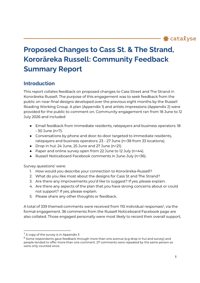
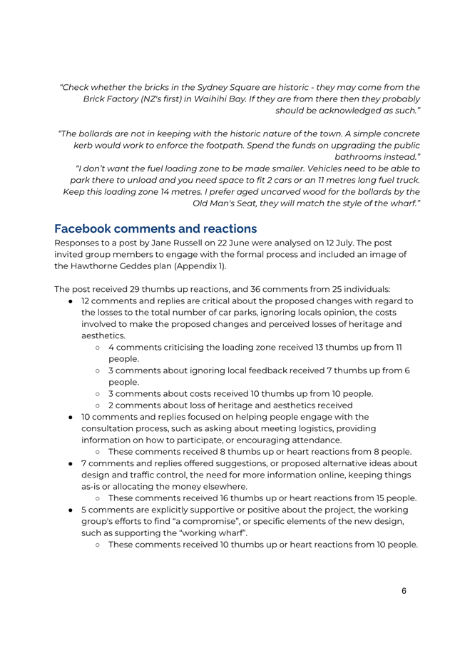
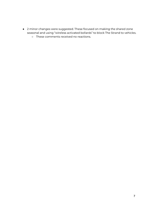
· This report summarises the public feedback obtained via community engagement that took place between 18 June and 12 July
2026.
· A total of 339 comments from 110 individual responses were received
through active engagement and via a survey. A further 36 comments from
the Russell Noticeboard Facebook page were also analysed.
· After considering the feedback received on the proposed design,
staff recommend the following minor changes:
o 1) move the bollards along the south-eastern portion of Cass Street,
adjacent to the delivery and drop-off zone, to the carriageway side of the
drainage channel;
o 2) include the following additional signage at the final discretion
of the Transport Group):
§ a 10kph sign near the refuelling loading zone on The Strand
§ add a No Left Turn sign midway along Cass Street and adjacent to the
Cass and York Street intersection (to direct traffic turning onto or travelling
east along Cass Street)
§ sufficient signage to inform how long vehicles can remain parked in
the various carparks along Cass Street
o 3) install a cycle parking rack.
· This report also seeks endorsement to change the construction
material for the raised crossing at the entrance to
Cass St, to a lower-cost and higher-durability material.
· Funding up to a value of $113,807.08 to implement the
final design plan has been allocated via previous Bay of Islands-Whangaroa
Community Board resolution 2026/35.
· An update on changes required to Far North District Council Parking
Bylaw and Road Use Bylaw, to facilitate permanent changes to Cass St and The
Strand is provided.
|
tŪtohunga / Recommendation
That the Bay of Islands-Whangaroa Community Board:
a) Recommend that
Te Koukou Committee for Transport and Infrastructure endorse to Council for
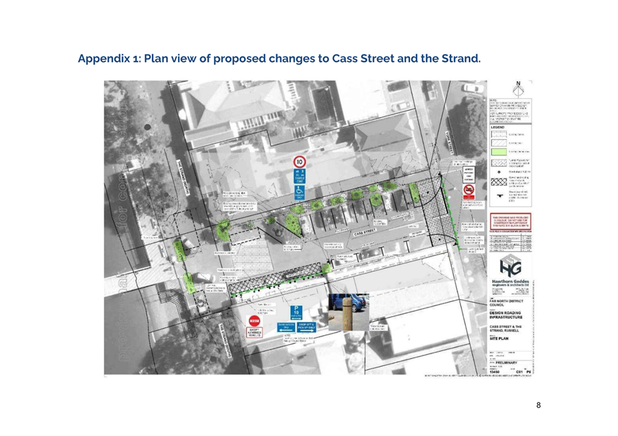
approval the final design plan for Cass Street and The Strand, per Attachment
1, with the following changes (as detailed in Section 2 of this report):
i. Shift
proposed pedestrian safety bollards, provide additional signage, and install
a cycle parking rack.
ii. Endorses
grey-tinted concrete as the proposed construction material for the raised
crossing entrance to Cass St (from York St)
b) Recommend
that Te Kūkupa Committee for Strategy, Policy and Regulation approve:
i. the
Parking Bylaw Schedules and Maps be amended as indicated in the final design
plan for changes to The Strand and Cass Street in Russell-Kororāreka,
per Attachment 1, with the following changes (as detailed in Section 2 of
this report), once the new parking spaces have been installed and marked out,
and the appropriate signage has been erected.
ii. the
Road Use Bylaw be amended as indicated in the final design plan for changes
to The Strand and Cass Street in Russell-Kororāreka, per Attachment 1,
with the following changes (as detailed in Section 2 of this report).
|
1)
Tāhuhu Kōrero / Background
In 2022, the Board allocated $100,000 for placemaking in
Kororāreka-Russell. In early 2024, staff began a placemaking project for
Kororāreka-Russell involving extensive community engagement. This led to
the Kororāreka-Russell Placemaking Plan, which identified 11 priority
placemaking outcomes.
One of the priority outcomes was to reduce vehicles on The
Strand. In December 2024, a temporary traffic trial was introduced on The
Strand and Cass Street. The trial tested new ways to manage vehicle access
along this busy and popular area, aiming to improve safety for pedestrians and
cyclists, reduce traffic congestion, and create a more welcoming space for
locals, visitors, and businesses.
In May 2025, a public consultation on the traffic trial
attracted 383 submissions, with 65.7 per cent of respondents supporting the
trial with pedestrian priority on some or all of The Strand.
In June 2025, the Bay of Islands-Whangaroa Community Board
endorsed the final Kororāreka - Russell Placemaking Plan 2025 (resolution
2025/59).
In July 2025, the council decided to permanently reduce
vehicles on The Strand via resolution 2025/80. This decision has resulted in
the final design plan in Attachment 1.
In October 2025, the Russell Roading Working Group (an
independent community group) was formed with support from council staff and
Community Board Member Hindle. This group has worked together with relevant
staff, including a transport engineer, to come up with the final design for
changes to Cass Street and The Strand that will achieve the outcomes decided by
Council resolution 2025/80. Refer https://www.fndc.govt.nz/Whats-New/current-projects/pedestrianisation-of-the-strand,-kororareka-russell
for a record of membership and meeting records.
In June 2026, the Bay of Islands-Whangaroa Community Board
endorsed a draft version of the design for changes to Cass Street and The
Strand to be engaged on for community feedback to inform the final version of
the design.
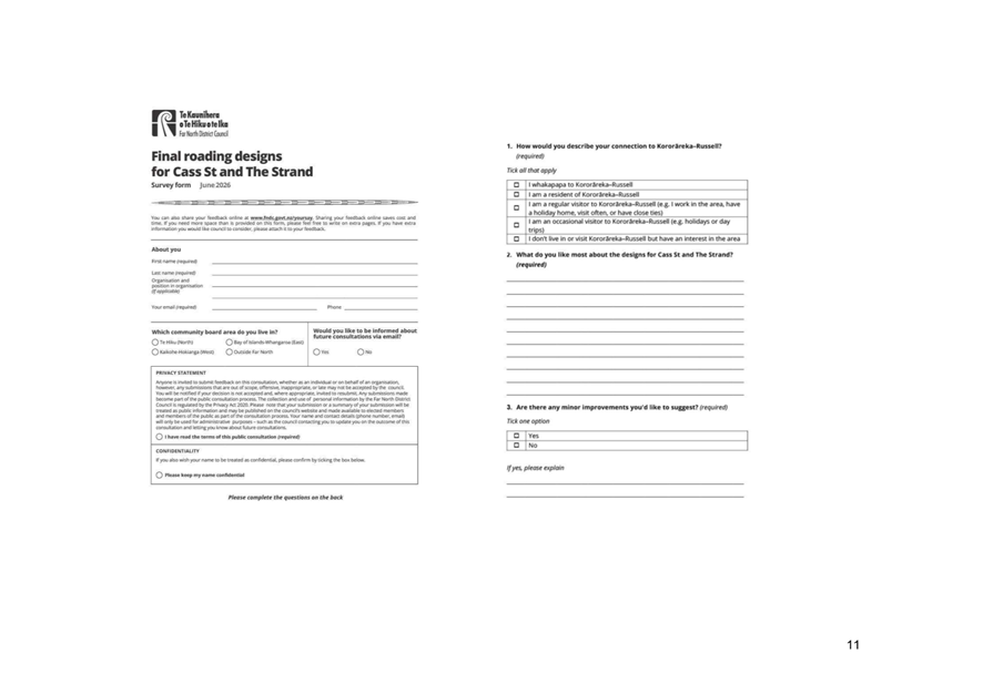
Between 18 June and 12 July 2026, engagement on the final
design for Cass Street and The Strand was undertaken. The public were invited
to view the final design plan and to provide their suggestions for minor
changes. A summary of feedback received during this engagement is discussed in
section 2, and a report on findings from this public consultation is provided
in Attachment 2.
Pending approval of the final design plan by Te Koukou, then
Council, the physical changes to Cass Street and The Strand (to reflect the
final design plan) can be scheduled and carried out by FNDC’s Transport
Department. The Russell Roading Working Group members have requested that the
Transport Group liaise with them while they undertake the physical works. The
purpose of this would be to keep the Russell Roading Working Group informed of
progress and to seek views from the Russell Roading Group, should that be
necessary during this stage of works.
Funding to implement changes to Cass Street and The Strand
was previously allocated via Bay of Islands-Whangaroa Community Board
resolution 2026/35. It should be noted that the allocated funding is estimated
to cover costs associated with the physical changes to the road environment but
is not sufficient to cover costs associated with the carving of the bollards on
Cass Street. Funding for the carving will need to be generated either through
community fundraising initiatives or future requests for Board funding. The
funding allocated comprises a total value of $113,807.08 from the following
fund allocations:
· $14,150.08 remaining balance from the original 2022 Bay of
Islands-Whangaroa Community Board Russell placemaking fund of $100,000
(currently being held by Far North Holdings Ltd, this fund will be invoiced
back into FNDC for allocation to Transport Group for the purpose of
implementing the design plan)
· $42,157 remaining from the 2024/2025 Eastern Town Beautification
Fund (carried into this financial year), and
· $57,500 of the 2025/2026 Eastern Town Beautification Fund (carried
into this financial year).
2) matapaki me
NgĀ KŌwhiringa / Discussion and Options
Suggested Changes to the Design for Cass Street and The
Strand as a result of Community Feedback
Community feedback responses ranged widely, with several
strongly worded individual responses often about elements that did not generate
strong responses from many others. Some suggestions are out of scope, such as
opening The Strand to all traffic on a seasonal basis. Others compromise
safety, such as removing bollards or placing carparks too close to
intersections. Several suggestions were operational, such as developing
enforcement plans and adding the changes to Google Maps.
The following is a summary breakdown of the level of
support, partial support or general opposition to the recommended design plan.
Refer to Attachment 2 for details of the feedback obtained.
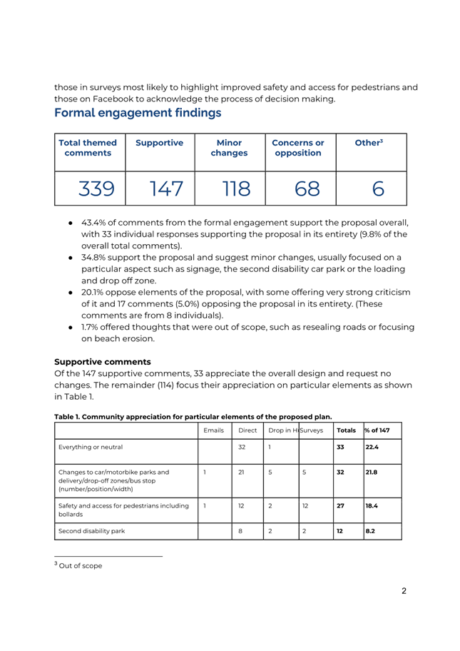
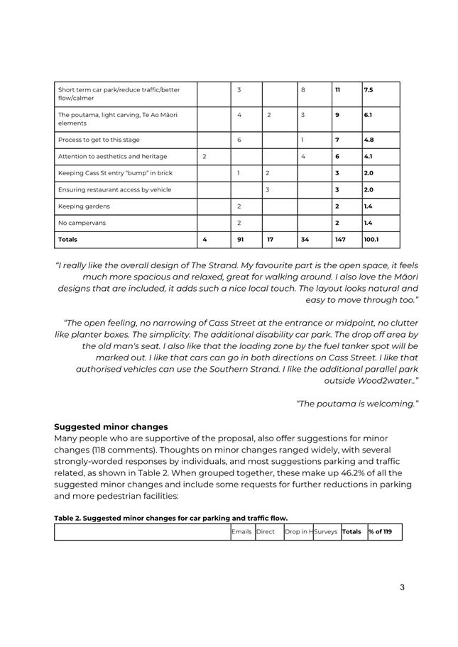
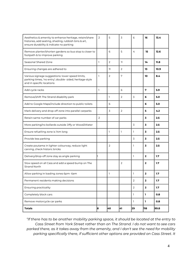
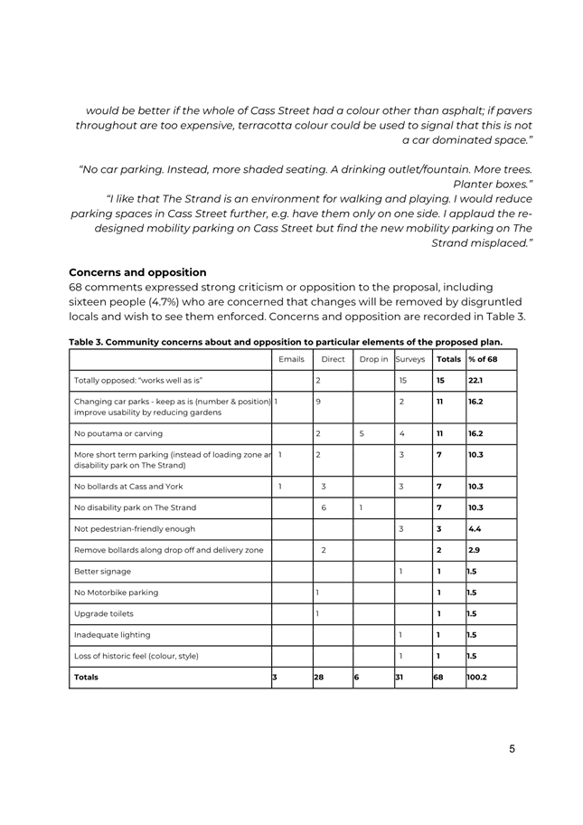
· 43.4% of comments received support for the proposal overall, with 33
individual responses supporting the proposal in its entirety (9.8%). Supportive comments received were broadly about improving safety and
access, appreciating the inclusion of artistic elements, as well as retaining
heritage and ensuring practicality.
· 34.8% support the proposal and suggest minor changes, usually
focused on a particular aspect such as signage, the second disability car park
or the loading and drop-off zone.
· 20.1% oppose elements of the proposal, with some offering very
strong criticism of it and 17 comments (5.0%) opposing the proposal in its
entirety. (These comments are from 8 individuals).
· 1.7% offered thoughts that were out of scope, such as resealing
roads or focusing on beach erosion.
78.2% of feedback received is in either full or partial
support of the proposed changes. Staff, in consultation with the transport
engineer, considered the suggested changes received during the feedback and
have identified three proposed changes to the design that are expected to help
achieve the purpose of the design plan and remain within the budget allocated
(discussed below).
Shift Proposed Pedestrian Safety Bollards
Retain but move all bollards along the south-western portion
of Cass Street, adjacent to the delivery and drop-off zone, to the carriageway
side of the drainage channel. The current design shows the bollards being
located on the footpath side of the drainage channel. This change would improve
pedestrian safety on the footpath in this area and would discourage angle
parking across the loading and drop-off zone.
Additional Signage
At the time of detailed design, the Project Manager responsible for
implementing the design plan will include the following additional signage at
the final discretion of the Transport Group:
§ a 10kph sign near the refuelling loading zone on The Strand
§ add a No Left Turn sign midway along Cass Street and adjacent to
Cass and York Street intersection (to direct traffic turning onto or travelling
east along Cass Street)
§ sufficient signage to inform how long vehicles can remain parked in
the various carparks along Cass Street
Including a Cycle Parking Rack
Cycle parking was not part of the original brief but was
suggested as part of the public engagement feedback. A cycle parking rack could
be added safely on The Strand, between trees, with a final location and method
of fixing to be determined by the Project Manager responsible for implementing
the design plan. With more cycle tracks being developed, these would be useful
and could be added at a later date if the current available funding will not
cover the purchasing and installation costs.
The following suggested changes were also considered,
however staff in consultation with the transport engineer, recommend rejecting
the following suggested changes.
Considering if car park widths can be increased by
reducing the existing garden beds as per image below:
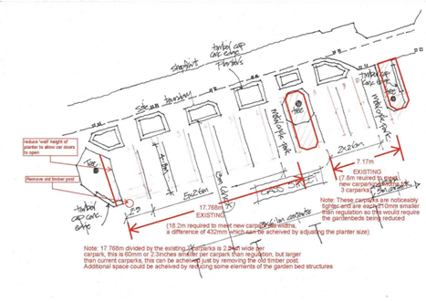
The reduction of the beds will require a full pavement
construction/extension, which will be both disruptive and relatively expensive.
The parking spaces drawn provide substantial additional width compared to a
standard space (2.4m). Additional width has been provided for the carpark
located nearest the high planter at the western end of the parking bay.
Provide angle parking where the proposed delivery and
drop-off zones are along the south-western side of Cass Street.
This is not feasible or safe as angle parking will encroach
into the vehicle carriageway.
Making the shared zone seasonal
This has already been considered by council and rejected.
Removing the proposed bollard outside Wood2Water
(south-eastern end of Cass Street)
This suggestion was rejected as the proposed bollard helps
to reduce traffic speed coming into Cass Street and prevents vehicles colliding
with parked cars.
Removing the disability park on The Strand
This was rejected because no alternative option is available
and an ageing community needs another accessible car park.
Moving the bus stop closer to the footpath by removing
the garden box behind it, and shortening the garden bed on the corner of Cass
Street and The Strand
This is not needed for passenger or road user safety and
allows existing Russell 2000 planter boxes to remain.
Extending the refuelling zone to 14m
This was not required as the refuelling trucks are a maximum
of 8.5m and thus can fit into a 9m loading zone. This was confirmed in
conversation with Allied Petroleum.
Changes to the poutama
Proposed changes to the poutama were rejected because brick
stains are temporary and do not damage the brick surface. The stain will
require regular upkeep to sustain the colour, so should the staining prove
unpopular or too expensive to maintain, the original colour of the bricks will
slowly show through. This decision may antagonise the small group opposing the
poutama due to the perceived historic value of the Square developed by the
Russell 2000 group, and of the bricks themselves which may have been hand-made
locally.
Options
The Bay of Islands-Whangaroa Community Board has the option
of:
endorsing
the design plan as shown in Attachment 1, without any of the changes
recommended above, or
endorsing
the design plan with all or some of the changes that are either recommended for
inclusion or rejection as set out above.
Suggested
Changes to the Design for Cass Street and The Strand - FNDC Transport
Department recommendation
As reported to the
Bay of Islands-Whangaroa Community Board on 4 June 2026, FNDC’s Transport
Department staff reviewed the draft design plan. They are generally supportive
of the plan; however, they recommend an alternative option for the raised
crossing at the entrance to Cass St (from York St). The Russell Roading Working
Group recommends construction via London Pavers (as shown on the design plan in
Attachment 1), while staff recommend using tinted concrete, which is more
durable, more stable, and lower-cost to install and maintain. During
engagement, three members of the public submitted on this topic, and all three
supported retaining the brick design. Altering the design would reduce
implementation costs by $9,600. Heritage New Zealand Pouhere Taonga staff have
also reviewed the plan and support it, as long as the tint used for the
concrete crossing is grey. This part of the town has significant cultural and
heritage values and is regulated to protect those values.
Update on changes required to Far North District Council Parking
Bylaw and Road Use Bylaw, to facilitate permanent changes to Cass St and The
Strand
Parking Bylaw
The Parking Bylaw Schedules and Maps will need to be amended
according to the changes in parking layout, time limits, and purpose, as
indicated in the final design plan for Cass Street and The Strand in
Russell-Kororāreka.
These changes to the Parking Bylaw schedules and maps
include:
· Changes to public
parking
· Changes to
mobility parking
· Changes to
delivery and drop-off zones
· Changes to the
refuelling zone
A request for the amendments to the Parking Bylaw schedules
and maps will go to Council once the new parking has been installed and marked
out, and the appropriate signage has been erected.
The GIS measurements of each park will be collated and
updated in the Parking Bylaw Schedules, and maps updated according to the
changes in parking, once work has been completed to ensure accuracy.
The car parks will be monitored and managed by Council
parking compliance following the Parking Bylaw Schedule and Map amendments.
Road Use Bylaw
The Road Use Bylaw will require amendment to incorporate the
changes according to the final design plan for Cass Street and The Strand in
Russell-Kororāreka.
These changes are:
· The Strand is to
be a shared access road with pedestrians
· The Strand will
have limited vehicle access
· The Strand will
have one-way-only access
· The schedules and
maps for the Road Use Bylaw will need to be amended
· The amendments to
the Bylaw and its schedules and maps will require a Public Consultation over a
four-week period.
A request for the new amendments to the Road Use Bylaw, and
its schedules and maps to go out for consultation will need to be approved by
Council. This process will be led by the Policy and Bylaws Team, it will be
initiated once The Transport Department have completed the changes to Cass
Street and The Strand have been physically completed.
TAKE TŪTOHUNGA
/ REASON FOR THE RECOMMENDATION
Adopting the recommended final design plan, including the
recommended changes discussed above, will ensure that when parts of Cass Street
and The Strand become a Shared Zone, pedestrian safety can be achieved, while
also incorporating design features and elements that have been identified as
important by the community of Russell-Kororāreka.
Endorsing a final design plan up to Te Koukou and Council
for implementation will enable Council resolution 2025/80 to be achieved via
the introduction of a Shared Zone along The Strand, from the boat ramp at the
northern end to Pitt St to the southern end, and along Cass Street from
mid-block Cass St to its intersection with The Strand. The design also
introduces an Authorised Vehicles only restriction along The Strand from Cass
Street to Pitt Street.
3) PĀnga
PŪtea me ngĀ wĀhanga tahua / Financial Implications and
Budgetary Provision
As discussed above, funding to implement the majority of the
recommended design, including suggested changes, has been secured via previous
Bay of Islands-Whangaroa Community Board resolution 2026/35.
Āpitihanga
/ Attachments
1. Design
Plan - A5932085 ⇩

2. Engagement
Summary Report - A5932082 ⇩
Hōtaka Take Ōkawa / Compliance Schedule:
Full consideration has been given to the provisions of the
Local Government Act 2002 S77 in relation to decision-making, in particular:
1. A Local authority
must, in the course of the decision-making process,
a) Seek to identify all
reasonably practicable options for the achievement of the objective of a
decision; and
b) Assess the options in
terms of their advantages and disadvantages; and
c) If any of the options
identified under paragraph (a) involves a significant decision in relation to
land or a body of water, take into account the relationship of Māori and
their culture and traditions with their ancestral land, water sites, waahi tapu,
valued flora and fauna and other taonga.
2. This section is
subject to Section 79 - Compliance with procedures in relation to decisions.
|
He Take Ōkawa / Compliance
Requirement
|
Aromatawai Kaimahi / Staff
Assessment
|
|
State the level of significance (high or low) of the
issue or proposal as determined by the Council’s
Significance and Engagement Policy
|
The design plan is not assessed as having a high level
of significance in accordance with Councils’ Significance and
Engagement Policy, however, significant iterative public engagement since
2024 has informed the development of this placemaking outcome.
|
|
State the relevant Council policies (external or
internal), legislation, and/or community outcomes (as stated in the LTP) that
relate to this decision.
|
Accessibility Policy (2022)
Art and Memorials in Public Places Policy (2017)
Community Gardens Policy (2013)
Community Grant Policy (2024)
District Plan 2009
Footpath Policy (2016)
Heritage New Zealand Pouhere Taonga Act 2014
Iwi/Hapu Environmental Management Plans Policy (2016)
Local Government Act 2002
Long Term Plan (2024-2027)
Parks and Reserves Policy (2022)
Procurement Policy
Resource Management Act 1991
This outcome sees the implementation of an outcome
within the Russell Placemaking Plan, endorsed by Bay of Islands-Whangaroa
Community Board in June 2025.
|
|
State whether this issue or proposal has a District-wide
relevance and, if not, the ways in which the appropriate Community
Board’s views have been sought.
|
The Kororāreka-Russell Historic Township is of
district wide significance and the Community Board have been involved
throughout the process via the appointment of a Russell Roading Working Group
supported by a Community Board Member.
|
|
State the
possible implications for Māori and how Māori have been provided
with an opportunity to contribute to decision making if this decision is
significant and relates to land and/or any body of water.
State the
possible implications and how this report aligns with Te Tiriti o Waitangi /
The Treaty of Waitangi.
|
Hapū representation has been consistent throughout
this placemaking project, including hapū representation as a member of
the Russell Roading Working Group.
|
|
Identify persons likely to be affected by or have an
interest in the matter, and how you have given consideration to their views
or preferences (for example – youth, the aged and those with
disabilities).
|
This paper recommends a final design which has been the
subject of recent public engagement, to ensure that persons likely to be
affected by or have an interest in this matter, have been enabled to put
forward their views on this matter.
|
|
State the financial implications and where budgetary
provisions have been made to support this decision.
|
Funding has been previously allocated, as discussed in
this paper
Namely:
The funding allocated comprises a total value of
$113,807.08 from the following fund allocations:
• $14,150.08
remaining balance from the original 2022 Bay of Islands-Whangaroa Community
Board Russell placemaking fund (currently being held by Far North Holdings
Ltd, this fund will be invoiced back into FNDC for allocation to Transport
Group for the purpose of implementing the design plan)
• $42,157
remaining from the 2024/2025 Eastern Town Beautification Fund (carried into
this financial year), and
• $57,500
of the 2025/2026 Eastern Town Beautification Fund (carried into this
financial year).
|
|
Chief Financial Officer review.
|
The CFO has reviewed this report.
|